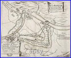
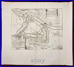
Plan de Belgrade Antique Map Eugene de Savoy Military 1729


Plan de Belgrade Antique Map Eugene de Savoy Military 1729. The antique map "Plan de Belgrade" is a copperplate engraving that was included in the book "Histoire Militaire Du Prince Eugene De Savoya" by J. The book was published by van der Kloot in Den Haag in 1729. The map depicts the city of Belgrade, which is the capital of Serbia, and was an important strategic location during the wars of the 18th century. The map shows the layout of the city, including its streets, buildings, and fortifications, as well as the surrounding landscape, including the Danube River. The engraving was created using a copperplate technique, which involved etching the image onto a copper plate and then using the plate to print the image onto paper. This was a popular technique for creating high-quality prints during the 18th century. Dimensions: 42,5 x 34 cm (print size) ; 17 x 13 inches (approx). From: "Histoire Militaire Du Prince Eugene De Savoya". Condition: Folded as issued, minor wrinkles.
For other details and the item's condition see the scans. More photos are available on demand.
This is an original antique map. We don't sell reproductions.
All items will be packed safely and properly to avoid any damage during their voyage. You just need to make a request for a separate invoice. Payments will be processed via. Credit and debit cards will be processed via the mentioned processors as well. After that, the buyers will be sent a reminder. It is possible to return an item within 30 days from the date of arrival.