Astracan Russia 1750 Bellin Nice Antique Map 18th Century
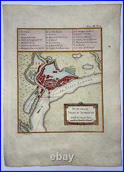

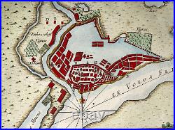

"PLAN DE LA VILLE D'ASTRACAN". Antique copper engraved map of Astrakan, in Russia.
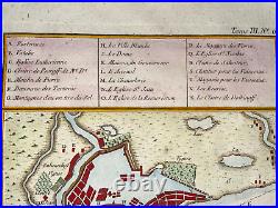
On upper part, the table of the main streets and edifices. In 1721 he entered the Depot des Cartes et Plans de la Marine, barely a year after the establishment of this institution. He will spend his whole life there, having found in the rich documentary collections (maps and logbooks) gathered in this place an ideal ground for his taste for compilation. He draws tirelessly from the mass of information made available to him, which also brings him some quarrels with sailors who consider themselves robbed of their work, for example D'Après de Mannevillette, who does not hesitate to lodge a complaint in this regard with the Academy of Sciences.All this did not really harm Bellin, who was officially appointed Royal Hydrographic Engineer and Geographer Engineer of the Navy and Deposit of Maps and Plans in Paris. 23,7 x 22 cm / 12,9 x 9 inches.
WE DON'T SELL LASER AND COPIES MAPS, ALL WE SELL IS ORIGINAL AND ANTIQUE. Due to the age an type of paper, some imperfections are to be expected. Please examine the images provided carefully, and if you have any questions please ask and we will be happy to help you.