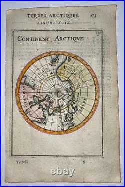
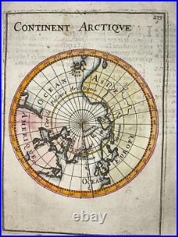
Arctic Circle 1683 Alain Manesson Mallet Antique Map French Edition 17th Century


The map shows the North Pole with Greenland, Terre de Spitzberg, Terre de Iesso (Hokkaido) and the neighboring continents America, Asia and Europe. Size with margins : 13 x 20 cm / 5,1 x 7,8 inches. Condition : very good condition, in colors.
Edition : Paris, 1683, 17th century. WE DON'T SELL LASER AND COPIES MAPS, ALL WE SELL IS ORIGINAL AND ANTIQUE. Due to the age an type of paper, some imperfections are to be expected. Please examine the images provided carefully, and if you have any questions please ask and we will be happy to help you.
