Antique Map of Asia Chinese Empire Empire of Japan 19th Century China


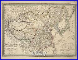
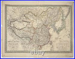
Antique Map of Asia - Chinese Empire - Empire of Japan - 19th Century - China. A fine example of Carl Ferdinand Weiland's 1832 map "Das Chinesische Reich und das Kaiserthum Japan" (The Chinese Empire and the Empire of Japan). In the bottom left corner, the map's title, year of creation, and authors are located, while the legend of the map is positioned in the bottom right corner. Many more antique maps and prints on dahlstromsfineart.
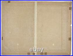
Size: 27" x 21" inches / 69 cm x 54 cm. We provide a Certificate of Authenticity upon request.There are some irregularities and tears along the edges of the map, as well as a vertical crease in the middle. Additionally, there is a slight foxing, barely noticeable on the paper. We offers a tracking link to ensure peace of mind. All our artworks are packaged to a very high standard, using protective decorative tissue paper and hardboard backing in a cardboard envelope. Sign up to our newsletter for special offers.
Welcome to our Antique Print Shop we Are a Family run Gallery trading in Antique Prints, Maps, Drawings and Photographs. So all you see here in Our Store is all Original Pieces the date they carry is the actual date/year they were printed.
Based in Sweden we are proud members of The Swedish Fine Art Print Society at The National Gallery, and been trading for the past 51 years, welcome to our Online Gallery. Enjoy and have a Great Day! Listing and template services provided by inkFrog.