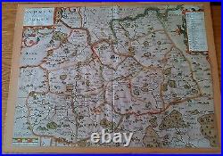
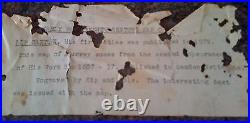
17th Century Map of Surrey by Kip Saxton


HIS FIRST ATLAS WAS PRODUCED IN 1579. THE MAP MEASURES 14½ INCHES x 11½ INCHES. ORIGINALLY IT HAD A 1/8 INCH BORDER BUT THIS HAS BEEN TRIMMED OFF. VAT INVOICE CAN BE SUPPLIED IF REQUIRED.


HIS FIRST ATLAS WAS PRODUCED IN 1579. THE MAP MEASURES 14½ INCHES x 11½ INCHES. ORIGINALLY IT HAD A 1/8 INCH BORDER BUT THIS HAS BEEN TRIMMED OFF. VAT INVOICE CAN BE SUPPLIED IF REQUIRED.
